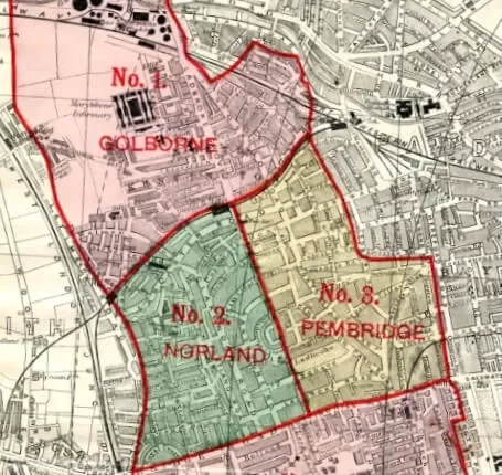
North Kensington
When we build our landscape around places to go, we lose places to be.
“In a city the street must be supreme. It is the first institution of the city. The street is a room by agreement, a community room, the walls of which belong to the donors, dedicated to the city for common use. Its ceiling is the sky. Today, streets are disinterested movements not at all belonging to the houses that front them. So you have no streets. You have roads, but you have no streets.” – Louis Kahn, The Street
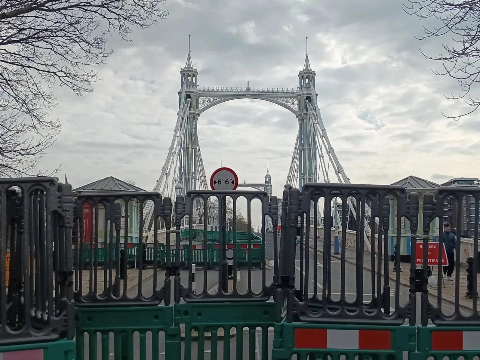
North Kensington as we know it today was made possible and shaped with the construction of London’s railways in the late nineteenth century. While stately homes were built amongst farms and aristocratic estates in the 18th century served by horses and carriages, it was the world’s first underground railway that opened the suburbs up for London’s booming population. Since then, North Kensington has welcomed waves of newcomers seeking new lives and opportunities from all corners of the world. North Kensington developed vibrant communities, shaped by the people and cultures that settled here. Besides World War II, it is probably the motor vehicle that has shaped our community most significantly with the Westway carving through huge swathes of housing in North Kensington, the swelling volume of traffic and the ever-booming size of modern motor vehicles on a nineteenth century road network. Has the character and heritage of our streets been lost to this late 20th century fad?
North Kensington map from 1910 with a lot more railway links
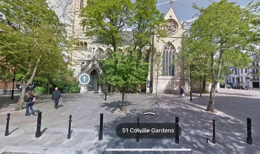
Another example is the pedestrianised front of All Saints Church; again in the early 1980s a section of Talbot road was pedestrianised and later planted with trees, creating what is today a popular relaxed walking and cycling route and somewhere you will often find people meeting and chatting. Along with where Tavistock Road meets Portobello Road, a popular pedestrianised square surrounded by cafes and restaurants, these examples demonstrate the impact of creating ‘places to be’ can have and their wider influence on surrounding streets.
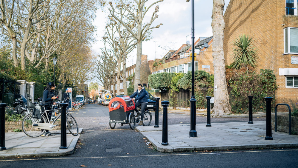
During the pandemic we have all had a little more time to explore our neighbourhoods. As we come out of lockdown and enjoy the sun and all the new outdoor seating popping up, we perhaps are rediscovering what it is like to not just see our streets as roads and places to park cars but places to be in our local neighbourhoods.
These do not just have to be places to eat and drink – they can be places where we can just sit and relax, for communities to enjoy, meet neighbours and friends for a chat, where children can play and places that are nice to walk or cycle through.
They are places that can have trees and plants to improve air quality, increase biodiversity, connect communities; create networks of quiet streets that encourage walking and cycling, support wellbeing, reduces noise levels and make it safer; support local businesses and create new opportunities.
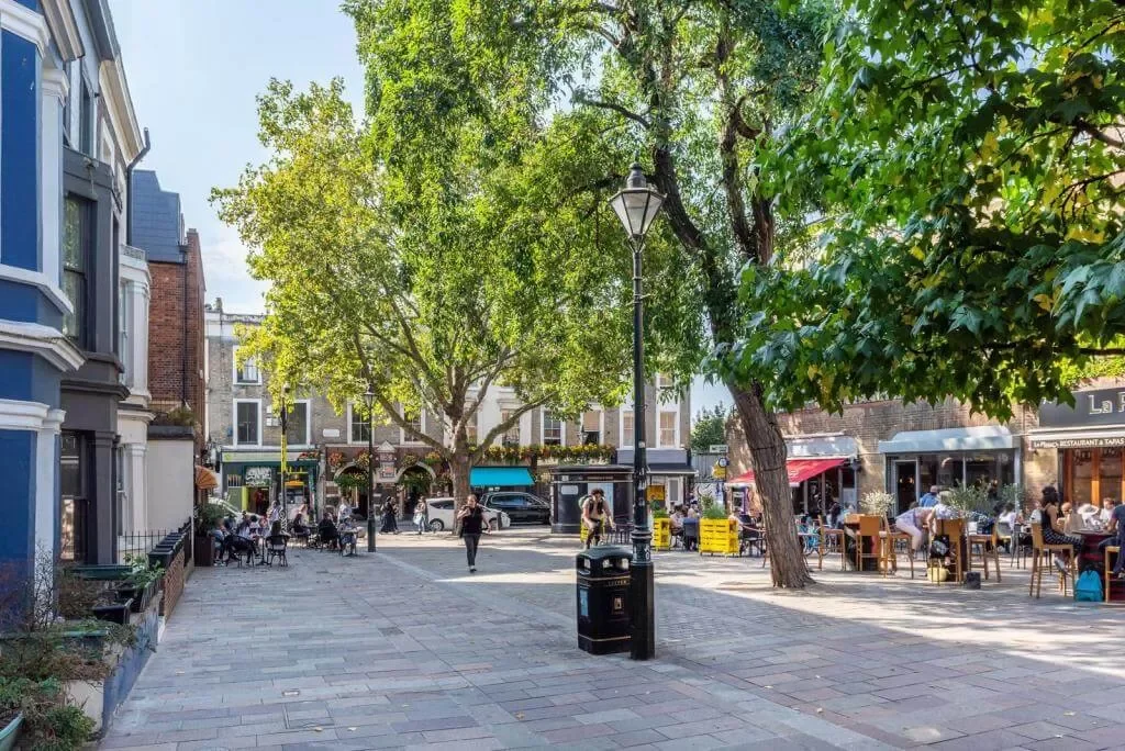
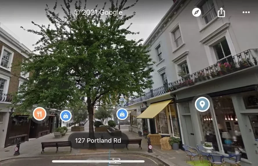
We do not have to look far to see what is possible. Clarendon Cross/Portland Road is an example where a junction was pedestrianised in the late 20th century with trees, raised planting and seating, creating a space cherished by many today. It can be no coincidence there remains a vibrant village atmosphere with independent shops surrounding a now mature tree and a place where you can stop, sit, and enjoy a pocket of calmness.
What else is possible in North Kensington? There will be many places we walk past every day and may have thought ‘It would be nice if there were more trees and plants…’. Or streets that are hugely popular with people walking, but there just is not enough space. Or maybe you have seen a street elsewhere in London or on holiday and thought ‘It would be nice if we could have a little bit of that in North Kensington’. Just like the examples above, small changes can have big benefits. A series of well-planned small changes across North Kensington could deliver significant benefits for North Ken residents and businesses.
Rather than just doing one-off initiatives here and there across the borough, perhaps we could look at North Kensington and start to think about a local plan. A plan developed by residents, community groups and local businesses. A plan that would reflect our priorities as well as enhance the character and identity of our unique and distinct corner of London. There are a series of council initiatives happening, yet they feel disjointed and lacking cohesion. Most recently there were a series of workshops in early 2021 organised by the council to discuss with residents and local businesses what it is that makes Portobello and Golborne roads special and what could be done to enhance the markets. There was much discussion about how the area can maintain healthy markets with a good mix of independent retail while keeping the spirit and energy of the area that we as residents all love so much.
There does seem to be an elephant in the room when we are talking about such plans with Kensington and Chelsea Council. While every major city in the world is redesigning their cities around people and not the motor vehicle, our council is not. It does not recognise that the status quo is not working for the here and now, let alone for the future, and the council will not be able to deliver meaningful change while it fails to accept this. Of course, motor vehicles have a role and place no one is pretending otherwise, but anyone thinking our streets are harmoniously balanced is simply ignoring the reality and how the status quo contributes to inequality. Around the world people are rethinking what city life should be and are creating ‘places to be’.
What is possible in North Kensington?
Portobello & Golborne Markets
Take the bottom end of Portobello Road, as it joins Pembridge Road near Notting Hill Gate. This is a one-way street that is a popular route for people walking and come market days and weekends it is thronged with visitors and tourists wandering up to the markets. The pavements are rather narrow – towards Chepstow Villas one side is practically unusable and at the Notting Hill end they disappear, replaced by parked cars. Besides the bright yellow pub on the corner, the junction with Pembridge Road is wide and a rather nondescript gateway to the borough’s most valued cultural destination.
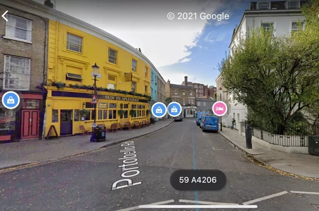
Bottom of Portobello Road Now
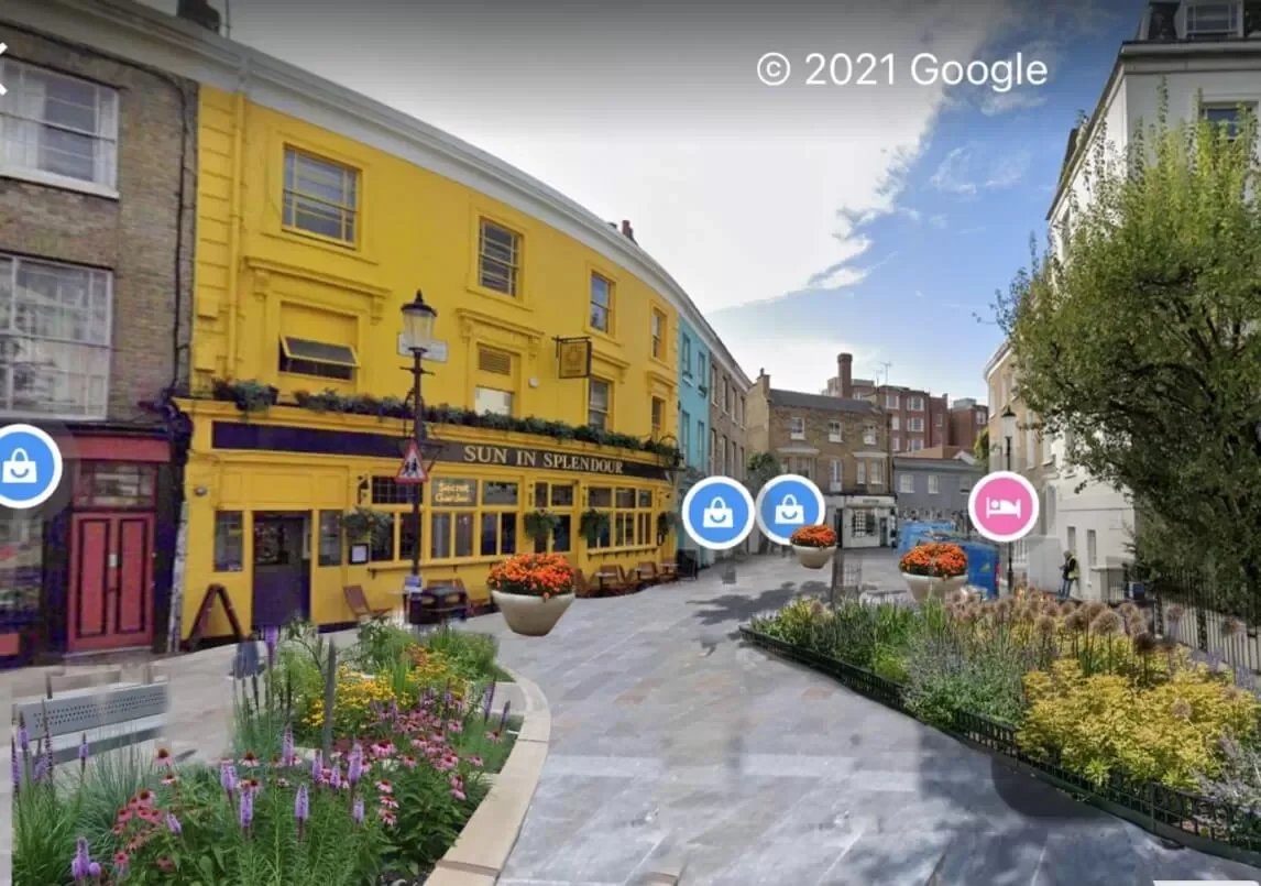
Taking inspiration from Pembridge Square just around the corner, where a flower bed was recently created and a delightful patch of wildflowers planted, the Portobello Road junction could be a quite different place, welcoming residents and visitors alike to North Kensington.
Narrowing the junction would not just make it safer, reducing the turning speeds of vehicles entering the busy pedestrian route.
It could become a nice place to rest, a better outdoor area for the pub and other local businesses, bring colour and life to this busy corner increasing biodiversity, improving air quality, and enhancing the character of one of the borough’s most important roads.
Bottom of Portobello Road Reimagined
The middle section of Portobello is pedestrianised some of the week, a welcome development – however, if we are to see the real opportunities of pedestrianisation we need to see more than an old sign and metal barriers dragged across the road.
A starter would be to introduce level paving along the whole stretch of Portobello. If the paving, illustrated above, were to be brought all the way up Portobello Road and across Golborne Road, it would improve the pedestrian environment, especially for those with mobility restrictions and reinforce the existing efforts to pedestrianise Portobello Road whilst maintaining access for residents and businesses. Pedestrians should be at the heart of Portobello Road.
As it is, the quality of the pavements are varied and often inadequate for the volume of people using the street. There would be other benefits such as enabling local cafes and restaurants to establish better outdoor offerings and a better trading environment for stall traders.
St Charles Square and Exmoor Street
St Charles Square is another unique place in North Kensington. Very few places in London have such a density of schools. St Charles College, established by Cardinal Manning in 1872 on newly acquired land, laid the foundations for St Charles Square as it is today, home to six educational institutions (St Charles nursery, St Charles primary school, The Lloyd Willaimson school, All Saints and St Charles colleges and La Petite École Française) with Barlby and the new Kensington Queensmill schools adjacent off Exmoor Street. This small patch of North Kensington has educated generations of children and continues today with nearly 3,000 students in total across all the schools and colleges. Yet as any parent will know the roads around the schools are far from healthy and safe with a lot of school traffic but also a lot of rat running off Ladbroke Grove and Barlby Road.
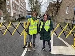
Surely we can make this small patch of North Ken better for the nearly 3,000 young people who come each day to be inspired and educated about what is possible…? The RBKC council has recently started a ‘school street’ outside All Saints College. School streets are when section of road near a school is closed to motor traffic (except residents) during the hour around the start and finish times of schools.
The aim is to create lower traffic environments that make is easier and safer for children to walk, cycle, scoot, run, rollerblade to school.
This is to be welcomed, yet it does not solve the main issue of traffic around the square – also there is a question of sustainability with each school street in the borough currently reliant on volunteers to man barriers.
A series of small changes could transform St Charles Square for students and residents alike. Firstly, there are a number of link roads around the square not used a lot by motor traffic but popular as routes for cycling and walking. These could be ‘filtered’ (motor vehicles restricted from passing through, but not walking and cycling) with trees, planting, seating and other features that would create new small urban parks that would continue to function as nice walking and cycling routes for residents, students and those heading to the local church or St Charles Hospital.
Secondly the through traffic needs to be reduced, much of which is drivers using St Charles Square and Exmoor Street to cut through avoiding a busy roundabout at the junction of Ladbroke Grove and Barlby Road. (Equally the traffic on Barlby Road needs to be addressed, and this gives rise to a discussion on how we want traffic managed across Dalgarno and St Helens wards). There are many approaches to reducing through traffic that are already used across North Kensington including filters (Dalgarno Gardens and Pottery Lane), diagonal filters (Clarendon Road and St Quintin Avenue), one-way systems (across Norland ward and Colville Terrace), pedestrianised sections (Talbot Road). Any of these could be used around St Charles Square (equally around Dalgarno and St Helens wards) to reduce through traffic and make the streets around 8 schools, used by nearly 3,000 children every day, a healthier and safer place for them and residents.
Latest Updates on this Campaign